CHARLOTTE (PINPOINT WEATHER) — We have a mixed bag of precipitation Sunday morning: snow, sleet, and freezing rain.
As the morning goes on, we will transition more to just sleet and freezing rain.
Temperatures are bitterly cold, only in the teens this morning, with wind chills in the single digits! We will only get high temperatures into the 20s for most of the day, with lower 30s later this evening.
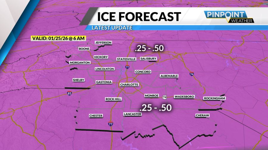
Freezing rain and sleet will continue through the late morning hours, with a brief break in the precipitation for most of the region around noon.
By 4 p.m., expect the freezing rain and sleet to build back in widespread over the area; this will be the cold front pushing through the region.


The cold front is coming in faster this morning compared to what the models were showing yesterday.
The good news out of that is we will be drying out quicker Sunday, probably around 8 to 9 p.m.
However, the winds will pick up earlier in the day because the front is arriving earlier. This means that power outages could pick up for the late afternoon and evening.
The ice will be weighing on the trees and powerlines all day, and gusts around 20-25 mph could enhance the threat for downed trees and lines.

We become dry and clear tonight, with a few flurries in the mountains through Monday morning. Dropping into the 20s tonight.
Following this storm will be dangerously cold temperatures, with high temperatures in the 20s and 30s, and overnight low temperatures in the single digits and teens. There are signs that this Arctic air will continue all the way through the week and into next weekend.
This could delay melting and recovery. Stay safe, warm, and take care of each other.


Download the Pinpoint Weather app today!
iPhone and iPad users, CLICK HERE.
Android users, CLICK HERE.