CHARLOTTE (PINPOINT WEATHER) — We are tracking record warmth on Tuesday and Wednesday across the region.
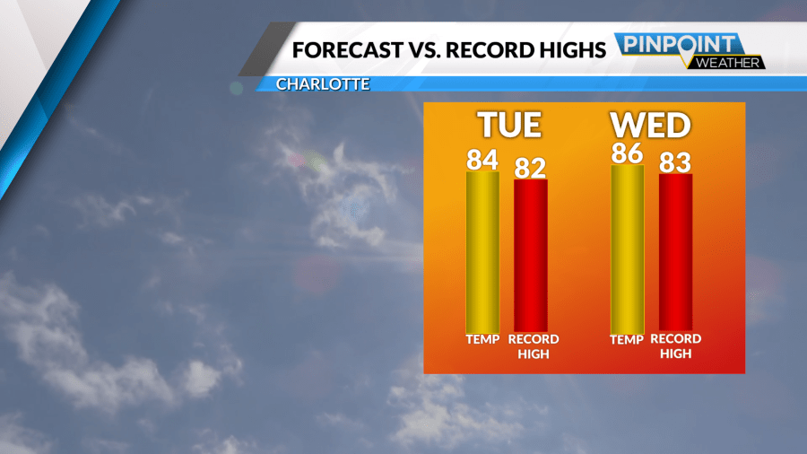
Temperatures are starting mild Tuesday morning in the 50s and lower 60s. A few clouds for the morning, but we will receive plenty of sunshine for the afternoon, helping temperatures obliterate records on Tuesday.
High temperatures will rise into the low to mid-80s across the area, with 70s in the mountains.
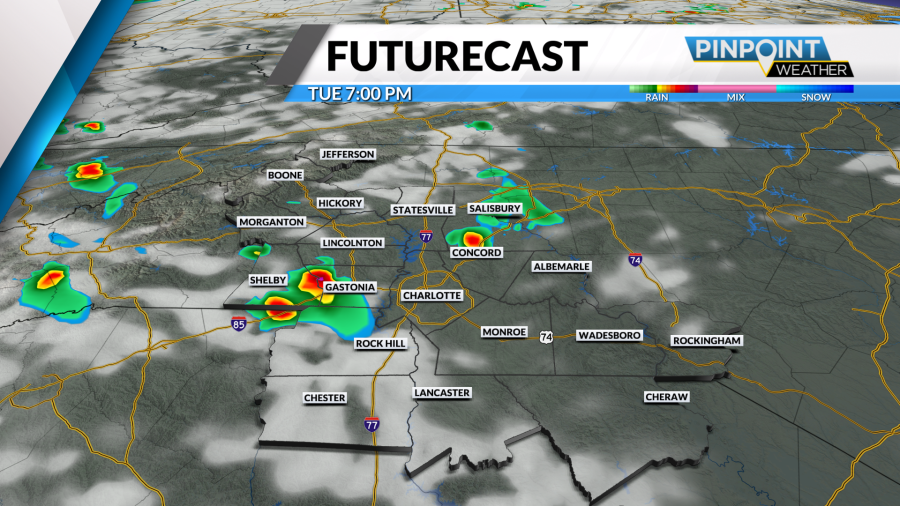
An isolated shower or storm is possible Tuesday afternoon and evening. Nothing severe, but a brief downpour and a quick rumble of thunder is likely for some.
Staying very warm overnight, with lows falling into the low to mid-60s, which will likely break record lows for Wednesday morning.
Wednesday will be even warmer than Tuesday, with more highs in the mid-80s. A stray shower chance is possible for Wednesday, but most will remain dry.



A cold front moves in late Wednesday night into Thursday morning. Rain is likely Thursday morning through Thursday afternoon, with possibly a few thunderstorms. Likely up to an inch of rain for the region, a good soaker for an area desperate for rain.
We will start in the 60s on Thursday and drop into the 50s for the afternoon.
The 60s will continue for Friday, but the 70s will make a comeback for the weekend.